“The future of navigation is inertial plus . . . some other sensor,” states Michael Braasch at the opening of this month’s webinar. “One sensor suite determines position, velocity and attitude.”
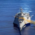
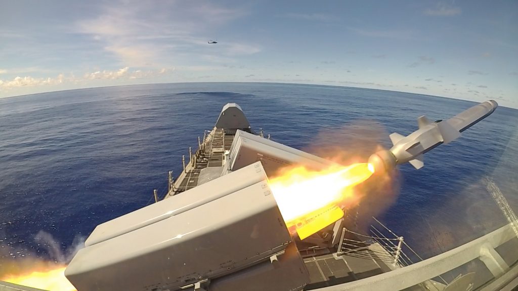
For the first time, a sophisticated GPS-guided Naval Strike Missile fired from the deck of a U.S. combat ship sailing in the Indo-Pacific region.
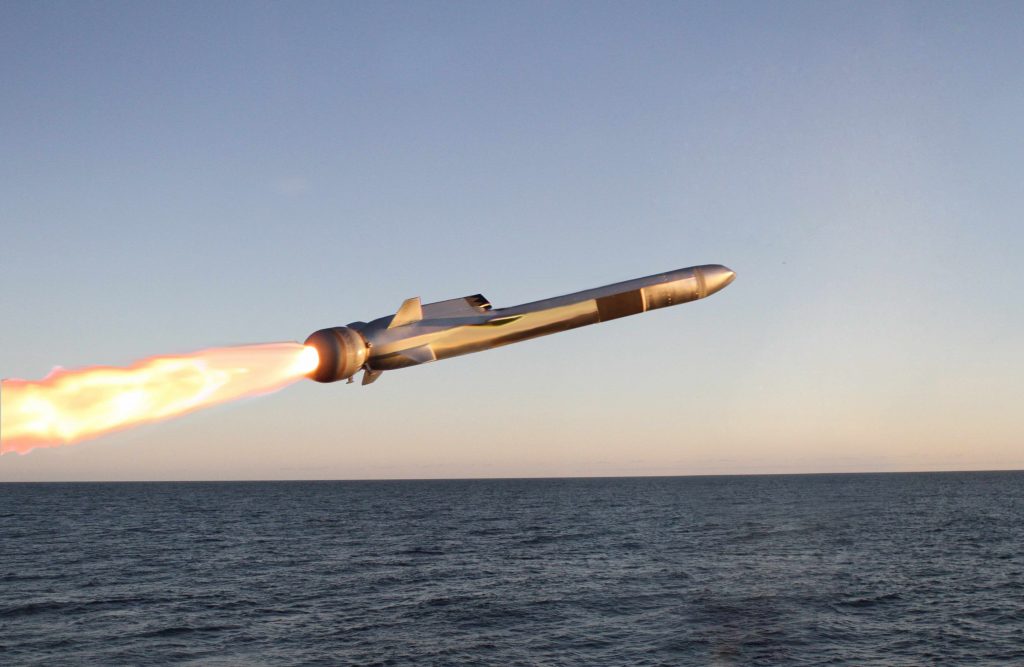
The USS Gabrielle Giffords launched the precision strike weapon, which “can find and destroy enemy ships at distances up to 100 nautical miles away,” according to a U.S. Navy statement. The NSM flies at high subsonic speed an “at sea-skimming altitude, has terrain-following capability and uses an advanced seeker for precise targeting in challenging conditions.”
The NSM can navigate by GPS, inertial and terrain reference systems. It is able to fly over and around landmasses, travel in sea skim mode, and make random avoidance maneuvers in the terminal phase. An imaging infrared (IIR) seeker and an onboard target database give NSM independent detection, recognition, and discrimination capabilities for targets at sea or on the coast. Its design and materials endow it with stealth capabilities. It weighs slightly over 400 kg (880 pounds) and has a range of at least 185 km (100 nm).
Known for its “sea-skimming” capability, the Naval Strike Missile can fly at very low altitudes over water and land. Photo: Kongsberg
The Navy Strike Missile launch was part of exercise Pacific Griffin, in the Philippine Sea near Guam, an exercise conducted with the Singaporean navy. It marked the second time such a missile was launched, but the first time it was fired in the Indo-Pacific region, according to the Navy.
Independence-variant littoral combat ship USS Gabrielle Giffords (LCS 10) launches a Naval Strike Missile (NSM) during exercise Pacific Griffin. The NSM is a long-range, precision strike weapon that is designed to find and destroy enemy ships. Pacific Griffin is a biennial exercise conducted in the waters near Guam aimed at enhancing combined proficiency at sea while strengthening relationships between the U.S. and Republic of Singapore navies. U.S. Navy photo by Chief Mass Communication Specialist Shannon Renfroe/Released.
The Navy awarded Raytheon a contract in 2018 for the weapons system, developed around the missile designed by Norwegian firm Kongsberg Defence & Aerospace.
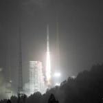
China sent a new BeiDou navigation satellite into orbit on a Long March-3A rocket from the Xichang Satellite Launch Center, in the southwestern Sichuan Province, at 4:58 a.m., Tuesday, July 10.
The satellite is the 32nd of the BeiDou navigation system, and one of the BeiDou-2 family, which is the second generation of the system. The state-run Xinhua press agency confirmed the launch within two hours after liftoff.
The U.S. Coast Guard’s Navigation Center (NAVCEN), and its commander Captain Russell Holmes, received special honors at a ceremony where Holmes officially took his leave for New Orleans and a new post as officer in charge of marine inspection for the outer continental shelf.
The Cospas-Sarsat MEOSAR (Medium-Altitude Earth Orbit Search and Rescue) system has been in the news quite a bit of late, and with good reason. As the technology has evolved, so too has the ability to improve search and rescue operations which save lives.
The cover story for the current issue of Inside GNSS is dedicated to the Cospas-Sarsat MEOSAR system and its role as a solution to support the ICAO GADSS Autonomous Distress Tracking recommendation.
SBG Systems released the Navsight Marine Solution at the recent Oceanology International trade show in London. The solution consists of an Inertial Measurement Unit (IMU) available at two different performance levels (from shallow to deep water), and connected to Navsight, a rugged processing unit embedding the fusion intelligence, the GNSS receiver when selected, and all connections to external equipment such as echo-sounders, sonar, etc.
The Federal Communications Commission (FCC) has declined to take action on concerns expressed by the GPS community, approving an Iridium request to modify its earth station licenses to take advantage of the advanced capabilities of its second-generation constellation.
Close to 300 users attended the 1st Galileo User Assembly, held in Madrid, Spain on November 28-29. The users, along with several expert presenters, came together for the first EGNSS User Consultation Platform to share their experience, discuss their needs and provide feedback on Galileo performance, one year after the launch of Galileo Initial Services.
NovAtel announced Wednesday that its GPS Anti-Jam Technology (GAJT) has been selected for the United Kingdom’s Type 26 Frigates to meet a requirement as part of a protected navigation system. These vessels are 21st Century warships that will replace the Type 23 Frigate as the workhorse of the British Fleet, undertaking the Royal Navy’s three core roles – warfighting, maritime security and international engagement – on the world stage.
As a child Stan Honey taught himself navigation and he admits he was “always good at math” and “just found navigation interesting.”
When he shared his many tales with the crowd in the Oregon Ballroom Tuesday night at the ION GNSS+ during the Plenary Session, the Yale- and Stanford-trained engineer entertained the audience with a wealth of information on early navigation systems, current navigation technologies, and how he and his colleagues developed many of the systems used to enhance the way millions of fans watch sports on television.
The ground was already shifting when Gen. John (Jay) Raymond took charge of Air Force Space Command (AFSPC) in October 2016. Just six months before, his predecessor Gen. John Hyten had announced the Space Enterprise Vision, a new way of approaching space asset development, management and protection now that space had become both contested and far more crowded. There were issues across the space, ground and user segments of the GPS program; sequestration was still looming and Congress was looking closely at how to reorganize the way the Air Force managed its space programs.
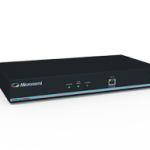
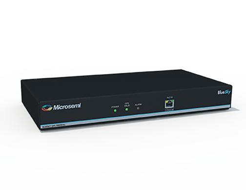
Microsemi’s BlueSky GPS Firewall is designed to provide security against GPS spoofing and jamming threats. Photo: Microsemi Corporation.
Microsemi Corporation, a provider of semiconductor solutions differentiated by power, security, reliability and performance, today announced the recent development of a breakthrough approach to protecting critical infrastructure against GPS spoofing and jamming threats with the introduction of its BlueSky GPS Firewall.
Hiroyuki Yamada is the Senior Deputy Director: Sub-Division for Operational Safety and Human Element, Maritime Safety Division, International Maritime Organization (IMO). The Sub-Division deals with all technical and operational matters related to navigation, communications, search and rescue and the human element of shipping.
Yamada has worked at IMO for 12 years in various positions related to ship safety. Previously he worked for the Japanese Government, mainly responsible for legislation and implementation of IMO regulations.